Southern jewel
The rugged island across the infamous Bass Strait is much more than just a pit stop at the end of the famous race from Sydney.
Written by Kevin Green
16 August 2018
Advertisement
Powerful Southern Ocean swells make their landfall on Tasmania’s breathtakingly wild coastline, which stretches south to 43 degrees before sloping northward along its exposed west coast and back to Bass Strait, where most of us sailors first encounter Tasmania.
Inshore, the waters are relatively mild in northern Tasmania. The cruising sailor can loiter in these sheltered estuaries where forests cascade down while the winding river, the Tamar, will take you toward Tasmania’s second town of Launceston.
While there, the picturesque Port Dalrymple Yacht Club is a good base for doing a shopping run. Then, with a favourable forecast from Tas Maritime Radio, allow a westerly to blow you the 90 miles east through Bass Strait to the Furneaux Group, an archipelago of about 100 islands just off the northeastern tip of Tasmania.
The careful navigator will have pored over charts and read the Tasmanian Anchorage Guide from the Royal Yacht Club of Tasmania (RYCT) and Australia Pilot (Volume 2) to make the most of this shoal-strewn area of high peaks and yellow sandy beaches. Apart from the pier at Flinders Island, this is unencumbered cruising, so best to be self-sufficient.
Advertisement
Departing Flinders Island, the infamous rough Pot Boil channel takes you out to Banks Strait and around the corner of mainland Tasmania. The wreck of the Farsund is a timely reminder that even in the most popular cruising grounds – the relatively sheltered east coast – the smart skipper should remain alert for the 145-nautical-mile run down to the next main shelter at Coles Bay; ideally done in a northerly wind so you can gybe south.
I recall doing this one night after leaving Flinders at dusk and being rewarded with the morning sun lighting up the peaks of Freycinet as we sailed into this vast waterway through the towering cliffs of the Schouten Passage. Around us, a few dolphins cavorted and the occasional seal drifted past, flippers up and snoozing.
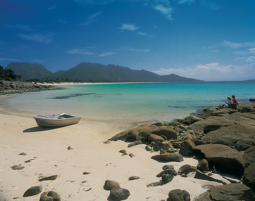
There’s plenty on offer at the all-weather anchorage at Coles Bay and the local wine region before the next major leg south. Alternatively, the more leisurely cruiser may take the shorter voyage (about 45 miles) from Flinders to the narrow, winding channel that leads into the game-fishing port of St Helens to walk the famous Bay of Fires.
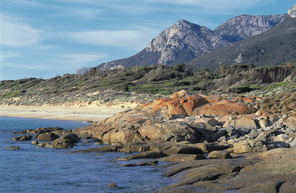
The Freycinet leg could be your last long, open water passage as you head for Maria Island, 27 miles south. Leaving it to port brings you into the heart of Tassie’s best cruising grounds within reach of Hobart. Those in a hurry – and enjoying mild conditions – may go offshore around the Tasman Peninsula, past the famous Cape Pillar and the booming surfing break at Shipstern Bluff at Cape Raoul. But it’s much more interesting to seek out the narrow Denison Canal and the secluded waters beyond.
The approaches to the nearby village of Dunalley are shallow – especially at Blackman Head – so are not suitable for all keelboats, but once through the sandy Flinders Bay there’s a myriad of inlets to drop anchor in.
This region can offer weeks of cruising if you take your time and the changeable weather allows it.
Beyond is the last leg across Storm Bay and into the confines of Hobart where there are several marinas and the famous Constitution Dock in the town centre, home to the Rolex Sydney Hobart fleet around 30 December. It’s also the home of the Australian Wooden Boat Show (8–11 February 2019), a biannual extravaganza and my favourite maritime event in Australia.
Cruising playground
I departed the last Wooden Boat Show by traditional means; in an 80-year-old whaleboat propelled by oars and lugsail. We were southbound for Tasmania’s most popular cruising grounds along the D’Entrecasteaux Channel. This 50-mile waterway is sheltered by Bruny Island to the east and the mainland to the west with many channels and river inlets to explore.
Named after the early French explorer Vice-Admiral Bruni D’Entrecasteaux who came here in 1792, the region has several marinas. The new Margate Marina near Snug lies at its northern end, running south to where the Admiral made his base at Recherche Bay; the last shelter before the wild southern coast.
Our whaleboat had been restored by the Living Boat Trust, a lively community-run place on the Huon River. Part of small boat flotilla called a raid (after the incursions of Vikings and other adventurers), we were returning to their home base in Franklin, a three-day sail south of Hobart.
Back on the whaler, I rested against the gunwhale as the light southerly breeze pushed us east along the River Derwent, away from Hobart. A cloudless Mount Wellington was a good sign and before long we were passing the marina at Sandy Bay and the Royal Yacht Club of Tasmania. Beyond, on high ground, our raiding party had visited the Semaphore Signal Station at Mount Nelson to survey our route.
Built in 1811, it was the first to be constructed in Tasmania. Overlooking Storm Bay and with clear views north to the old penal settlement at Port Arthur, it would have quickly passed signals about any escaped convicts down to the Hobart Garrison. Nowadays, it flies the Tasmanian state flag while international maritime signal flags are used to welcome visiting ships.
Our first stop after a long tiring row was the jetty at Dennes Point on Bruny Island where other smaller St Ayles skiffs ran up the beach before we all trudged uphill to the cafe. From the verandah we enjoyed stunning views west across the channel into North West Bay and the aptly named Snug village that nestles in its southern corner.
Further down the coast are the major yachting centres at Kettering, which has a chandlery, and beyond to the major river mouth of the Huon where the famous boatbuilding timber was cut. Beyond, the settlements become fewer; Southport is the last village before the peaks of the famous southwest wilderness region emerge.
It was with great excitement in February this year that my Tasmanian cousin Christian and I voyaged further south toward the island’s primeval southwest wilderness region. As the steel bow of our 32-foot Tahiti cutter Beatrice surged into the swells, I felt a long way from the milder climes of mainland Australia as the foreboding mass of Tasmania’s southwest cape loomed large on our starboard bow.
Australia Pilot describes this voyage as the Ultima Thule of Australian cruising, so we’d spent a year planning and keenly anticipating this three-week summer voyage that would entail about 300 nautical miles of sailing.
At 43 degrees south, we were amid the fabled roaring forties with very little shelter along Tasmania’s unpopulated southwest coast. Aboard Beatrice we steadily motor sailed south, passing Australia’s most southerly lighthouse on Maatsuyker Island where we encountered the first of the bull kelp beds, their 10-metre long stalks reaching up from the seabed to grasp the propeller of our American-designed double ender. Perched on the long bowsprit, I directed Christian beyond them. Before that it had been the lines of crab pots, so our voyage in light northerly winds was eventful. At last we sidled into the final sheltered anchorage at Recherche Bay.
In planning our voyage, Christian had been diligently watching the Bureau of Meteorology website for weeks. He knew our window of opportunity was small to go beyond Recherche for the 70-nautical-mile leg to Port Davey; the only sheltered and unbarred bay until Bass Strait. North of Port Davey lay the old penal settlement of Macquarie Harbour; its entrance name, Hell’s Mouth, aptly describing its precariousness in dubious weather.
So, no time was lost after overnighting in picturesque Recherche before we motor sailed off at sunrise, speeding south on calm seas and leaving our last mobile phone access point behind.
Passing bays and tall cliffs until the peak of Frenchman’s Cap glistened in the growing sunshine, the brooding mountains of the World Heritage listed Southwest wilderness region emerged resolutely beyond. This had been the last bastion of Tasmania’s indigenous peoples – the Needwonee and Ninene – until the arrival of white explorers, and later the tin miners of 1892, at a bay off our starboard bow named Cox’s Bight.
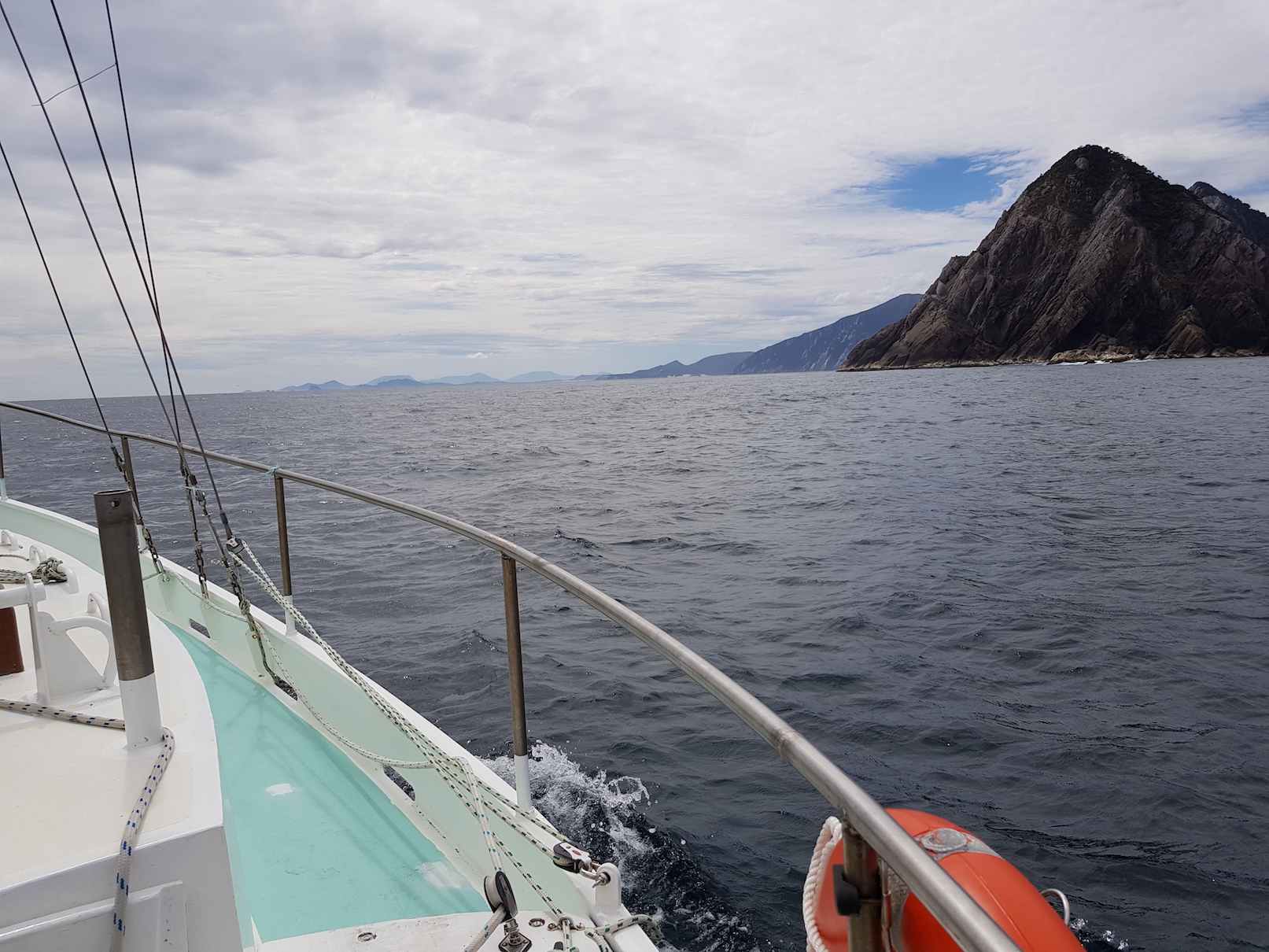
Albatrosses arrived along with a pod of dolphins to escort us around South West Cape, its grey pyramid headland giving way to lower lying cliffs that run almost uninterrupted for 14 miles to the entrance of Port Davey, our destination.
A dangerous lee shore in any kind of southerly or westerly wind, it was not a place for sightseeing. We kept our tanned sails full and Beatrice moving along with the jib and staysail pulling hard, along with the main.
Closely watching my Navionics chart, I piloted us past the outlying Pyramid Rocks at the Port Davey entrance. The charts showed reefs all around, so a dangerous place in a swell, but the calm of our arrival mirrored the tranquillity of this surreal landscape of glistening quartz headlands, shiny white sea stacks and green tidal reefs.
A small shark swam by us and then several seals emerged to stare forlornly at the interruption to their wild seascape. Sheerwaters sped past and pied cormorants stood sentinel on the outlying rocks as we glided toward the first anchorage, Spain Bay.
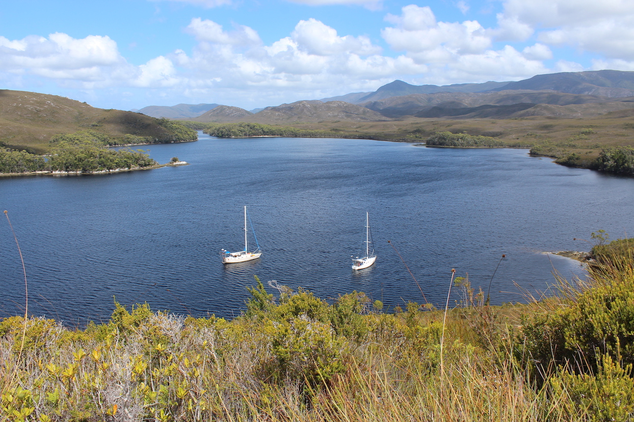
Two large waterways comprise this mountainous region that is also a marine reserve: the ocean bay of Port Davey and the land-locked Bathurst Harbour, which is reached via the fairly deep Bathurst Channel.
We were to spend the next two weeks exploring its dark brown waters and marvel at the beauty of this remote wilderness, only visited by a small and adventurous group of cruisers, and only when the weather allowed.
Advertisement
Advertisement
Advertisement
