Tropical migration
Every year when the south-east trades are blowing, dozens of cruising yachts join the procession northward along the east coast of Australia. Many are headed to North Queensland, to the stretch of coast between Townsville and Cairns – where they have their pick of over 50 stunning islands.
Written by Scott Alle
30 May 2019
Advertisement
A long time ago in what seems another life I spent a couple of years in Townsville and Cairns, and during weekend races wistfully contemplated each new island looming into view from the rail of an Adams 13 called Tobacco Road.
Even then I realised the combination of rainforest, turquoise water, sandy beaches, fringing reefs and natural wilderness was hard to beat, so I vowed some day to island hop.
I may get finally get back to Magnetic later this year, but the islands are there waiting for anyone who has the time to sample a unique world-class cruising destination.
TOWNSVILLE
The logical provisioning point for an extended visit to the islands further north, the Townsville Yacht Club is also a secure bolthole in unpleasant or worst case scenario: cyclonic weather. The club’s 165 berths can accommodate boats up to 20 metres; make sure you book ahead. There’s a full suite of amenities (showers, laundry, good wi-fi), for tired sailors requiring some civilised home comforts.
Advertisement
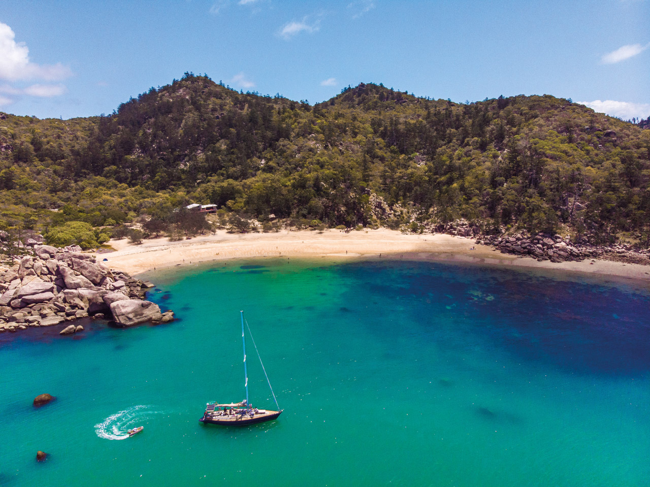
MAGNETIC ISLAND
Encompassing 23 bays and beaches with an area of 52 square kilometres, Magnetic Island offers a leisurely and, if you choose, luxurious first stop. From the Townsville Yacht Club it’s an easy six-nautical-mile sail to protected Nelly Bay.
Magnetic Island Marina in Nelly Bay has 106 reasonably priced berths ranging from 10 to 35 metres with three phase power, water and laundry facilities. Fuel is available from the local servo, and an IGA is easy walking distance from the marina.
Pilgrim Sailing, a beautiful 58-foot custom Kaufman sloop calls Magnetic Island home from April to October. Owners Claire and Paul Ley welcome guests aboard for a languid lunch, sunset cruises, or private charters. Outings include a relaxing swim or snorkelling at one of the island’s picturesque anchorages, complete with a visit to nearby sandy beaches and coral reefs.
Claire agrees the island, more than half of which is spectacular national park with hoop pines and walking trails, remains relatively uncrowded. “We usually have a bay or beach to ourselves,” she confesses. If the south-east trades are blowing strongly she recommends Horseshoe Bay on the northern side of the island, a well-known haunt for cruising yachties.
Other favourites are palm-fringed Radical Bay and Arthur Bay to experience more of this charming isle’s tranquil tropical waters.
There are five public moorings, three located in Florence Bay, one in Arthur Bay, and one solely for tenders in Geoffrey Bay.
PALM ISLANDS
From Magnetic Island the course is NW through the Palm Islands, between Eclipse Island and Falcon and Brisk Islands, next to the old Steamer Passage. The charts are accurate and there’s plenty of water. The island chain offers seclusion and sublime wilderness experiences.
The Palm Islands (S 18° 46’, E 146° 51’), are located 10 nautical miles off the coast. The chain is made up of over 12 islands including Orpheus, Pelorus, Fantome, Curacoa and Great Palm, which is almost the same size as Magnetic Island. In Casement Bay on Great Palm Island there is a large Aboriginal community where permission is required to land.
Only two islands are permanently inhabited. Visitors will delight in the crystal-clear waters and sandy beaches. The islands are lush, with mangroves, eucalypt forest, rainforests, hoop pine, mango, banana, papaya and wild plum trees.
Palm Island is part of the traditional lands and sea country of the Manbarra people, and is administered by the Palm Islands Aboriginal Shire Council. Pelorus Island is Crown Land, administrated by the Cardwell Shire Council.
ORPHEUS ISLAND
Orpheus Island is a national park, apart from 10 hectares of privately owned land. The island is 12 kilometres long and boasts 1,368 hectares of rainforest, woodlands, granite outcrops beaches and bays. Eight public moorings are now available; four in Pioneer Bay, two in Hazard Bay, and two for smaller vessels up to 10 metres at Yanks Jetty. Time limits apply during the day, but all moorings are available overnight between 3pm and 9am.
The island’s leeward western fringing reefs (Iris Point to Harrier Point) and bays (Cattle Bay, Pioneer Bay and Hazard Bay) are generally protected from the prevailing winter SE winds (June to Nov).
James Cook University’s Orpheus Island Research Station (OIRS) is located within Pioneer Bay. In Little Pioneer Bay you can go ashore, see the historic old Shepherd’s Hut and climb to the hill top. This Bay is coral/sand based and approximately 10 metres deep so it is best to try and take one of the public moorings, which can accommodate boats up to 20 metres.
From there, the route to Shepherd Bay at the north end of Hinchinbrook Island is straightforward.

HINCHINBROOK ISLAND
Alan Lucas, who wrote the definitive guide for this entire region, the extremely well-researched Cruising the Coral Coast, rates Zoe Bay as “perhaps the most beautiful place on the entire east coast of Australia”. Why?
It’s a serene location, with a wide deserted beach framed by the towering, rain forested peaks of the largest island on the Great Barrier Reef. Ten minutes’ walk from the beach is a pristine waterfall tumbling into a deep freshwater swimming hole with schools of jungle perch.
Located on Hinchinbrook’s east coast, Zoe Bay is ideal when there’s very little wind or the wind is from the north through to south west. Further along the coast, Shepherd Bay and the western side of Cape Richards offer better protection if the SE trades are gusting in. The western side of Hinchinbrook reputedly has the best selection of mangrove creek cyclone havens on Australia’s east coast. While Zoe Bay is zoned ‘yellow’ (few limitations) much of Hinchinbrook’s eastern shoreline from Zoe Bay northwards is zoned ‘green’, which means many activities (such as fishing) are limited or banned.
Hinchinbrook Island is a beautiful wilderness area spanning 39,300 hectares. It ranges from vast mangrove swamps and estuaries, to open beaches and rocky foreshores, sometimes with fringing reefs just offshore. It’s Australia’s largest island national park and home to the world famous 32-kilometre Thorsborne Trail.
A few cautionary notes: crocs and sharks also seem to appreciate Hinchinbrook’s natural bounties, while on land the sand flies and mosquitoes are apparently especially vicious. As you might expect.
In February 2011, Category 5 Cyclone Yasi smashed into the coast just south of Mission Beach. The storm wrought a wide arc of destruction, including trashing the Port Hinchinbrook Marina on the mainland. Due to protracted legal wrangling between former owners, the marina remains in disrepair and is unable to host visiting yachts.
BROOK AND GOOLD ISLANDS
Prising yourself away from Hinchinbrook and continuing your migration north, you pass in order, Goold Island and the Brook group of four islands. There is a public mooring off North Island. Access ashore is prohibited to protect nesting and roosting seabirds and shorebirds and their habitats, but kayaking, snorkelling and diving the unspoiled surrounding waters is allowed.
DUNK AND FAMILY ISLANDS
The Family Group of islands include Dunk, Bedarra, Timana, Wheeler, Coombe, Smith, Bowden and Hudson Islands. All are continental islands surrounded by deep water, usually with a sand spit anchorage on the north west side, granting easy dinghy access.
On Dunk Island, Brammo Bay is the main anchorage, sheltered in S/SE winds, so it’s a popular spot for visiting boats. The anchorage to the SW is for NE winds, and there are a few other bays around the island that you can drop an anchor in fair conditions. In Brammo Bay if possible anchor on the east side of the jetty and as close into the beach as depth will allow. There is a public mooring here, and one off Pallon Beach.
One of the few privately owned islands on the Queensland Coast, Dunk had a resort that was decimated by Cyclone Yasi, but in October 2018 it was announced a new group was planning to redevelop the site with an eco-tourism focus.
Bedarra Island is also privately owned having a resort on the SE approach, several freehold properties on the NE corner and a defunct resort on its NW side.

BARNARD ISLANDS
Of the seven continental islands in the chain, five (Jessie, Hutchinson, Sisters, Stephens and Bresnahan), are national parks, while Kent Island is a Commonwealth lighthouse reserve and Lindquist Island is a defence reserve.
All are metamorphic rock outcrops whose slopes are densely cloaked in rainforest, its diversity increasing with the size of the island. The fringing reefs are a mixture of coral and rock systems. Jessie Island features sea caves, while the southern side of Kent Island should provide suitable depths and adequate shelter from a northerly to spend the night in comfort.
FRANKLAND ISLANDS
The Frankland Group National Park consists of five continental islands: High, Normanby, Mabel, Round and Russell. All have fringing reefs. There are two public moorings off Russell Island and one off High Island. The shoreline of High Island is a mix of huge granite boulders and palm lined sand beaches. There is an anchorage on the NW corner which is ok in mild south easterly conditions.
FITZROY ISLAND
Fitzroy is located directly to the east of Cairns Harbour and requires a lazy half-day sail out around False Cape and Cape Grafton to get there. This heavily wooded island offers magnificent forest and beach walks, sensational snorkelling and scuba-diving direct from the beach, and it is a top anchorage affording unmatched mainland sunsets. There are 11 public moorings all on the NW and W of the island, but they go early. Foxy’s Bar & Grill is a great place to hang for sundowners and catch up with fellow yachties.
GREEN ISLAND
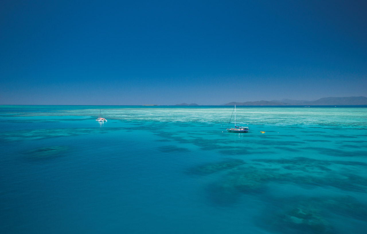
Green Island is a coral atoll in a protected marine park and is surrounded by coral reef. Three public moorings are available. Extensive areas of the surrounding reef are exposed at low water. On the island, showers, change rooms, shops and beach hire equipment are available. Visiting sailors can relax on the beach or stroll through the island’s cool green forest. There is an underwater observatory and opportunities for scuba and snorkel diving.
USEFUL CONTACTS
Go to gbrmpa.gov.au for reef zoning maps or you can order hard copies by phoning +61 7 4750 0700. Maps are also available at GBRMPA offices and at marine dealers and chandleries.
FURTHER READING
Cruising the Coral Coast – Alan Lucas
-

Advertisement
-
Advertisement
-

Advertisement